


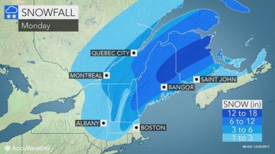
The Northern Seacoast could well be in the grips of blizzard conditions by the end of the day, with up to a foot of snow and 50 mph winds.
It's all part of a strengthening coastal storm that will continue to spread snow across the Northeast through Christmas Day.
As the storm strengthens, winds will increase enough to cause blowing and drifting snow, where a couple of inches or more snow has fallen. This could reduce visibility for travelers even after the snow is done falling.
In the Rochester area, snow is expected to end sometime this afternoon with winds increasing to 25-30 mph and gusts much higher.
"Wind gusts at times could reach 50 mph on Monday," said AccuWeather Meteorologist Bill Deger.
"In combination with the heavy, wet snow on tree limbs, winds of this magnitude are enough to cause sporadic power outages while families are gathered for holiday festivities," Deger added.
The storm warning here is predicted to end at 3 p.m.
The westerly wind behind the storm will usher in bitterly cold temperatures, with a low tonight of 15 and high on Tuesday of 22 with a wind chill of just 2 degrees
The arctic air pressing in behind the storm will cause temperatures to fall during Christmas Day. Any surfaces that became wet may freeze. Temperatures during much of next week will be below average.
(Accuweather material contributed to this report.)